Inglis Fm
Type Locality and Naming
Named after Inglis Island. Srinivasan and Azmi (1976), proposed Inglis Formation, for the nanno, foram chalk of Ritchies Archipelago.
[Original Publication: Srinivasan, M.S. and Azmi, R.J. (1976a) Contribution to the Stratigraphy of Neill Island, Ritchie’s Archipelago, Andaman Sea. Proc. VI Indian Colloq. Micropal. And Strat., pp. 283-301.]
Another reference section is Lacum Point Section, Havelock Island (Pandey and Dave, 1998)
Synonyms: At East Coast Cliff section of Henry Lawrence Island, it is represented by a marly facies. ‘Muralat Chalk’ which Karunakaran et al., (1968) used informally, seems to resemble Inglis Formation.
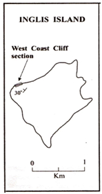
[Figure 1 = Map of Inglis Island showing the West Coast Cliff section (after Sharma and Srinivasan, 2007).]
Lithology and Thickness
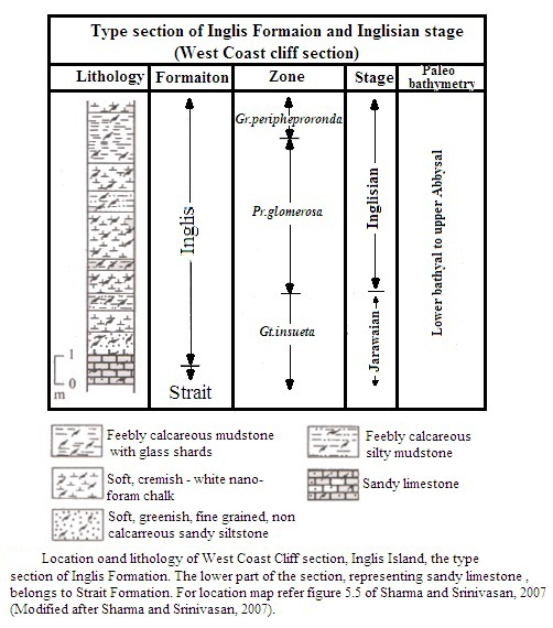
Chalk. This formation comprised of mainly of creamish-white nanno-foram or calcareous chalk. Within the formation, occasional bands of non-calcareous chalk/tephras with abundant glass shards also occur. In the type section, the formation consists of a small band of sandy siltstone at the base followed upwards by creamish yellow chalk. Chalk and silty mudstone alternate throughout the sequence in the type section. The maximum thickness has been observed in the Lacum Point Section of Havelock Island, where 280 m of the formation is represented.
[Figure 1 = Type section of Inglis Fm at West Coast Cliff section, Inglis Island. The sandy limestone in the lower part of the section belongs to the Strait Fm (after Sharma and Srinivasan, 2007)]
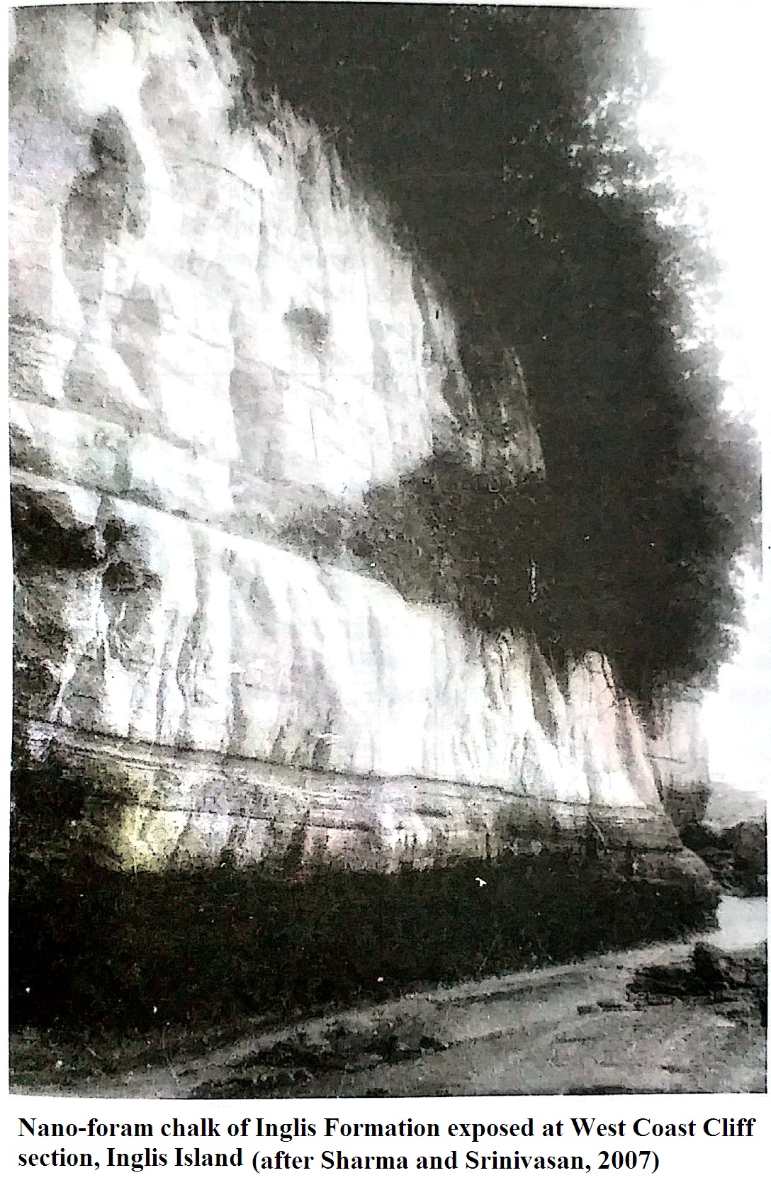
[Figure 2 = Nannofossil-foraminifer chalk of Inglis Fm at West Coast Cliff section, Inglis Island (after Sharma and Srinivasan, 2007)]
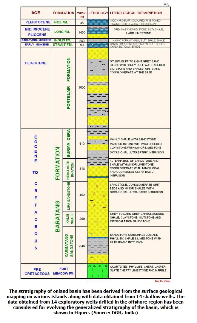
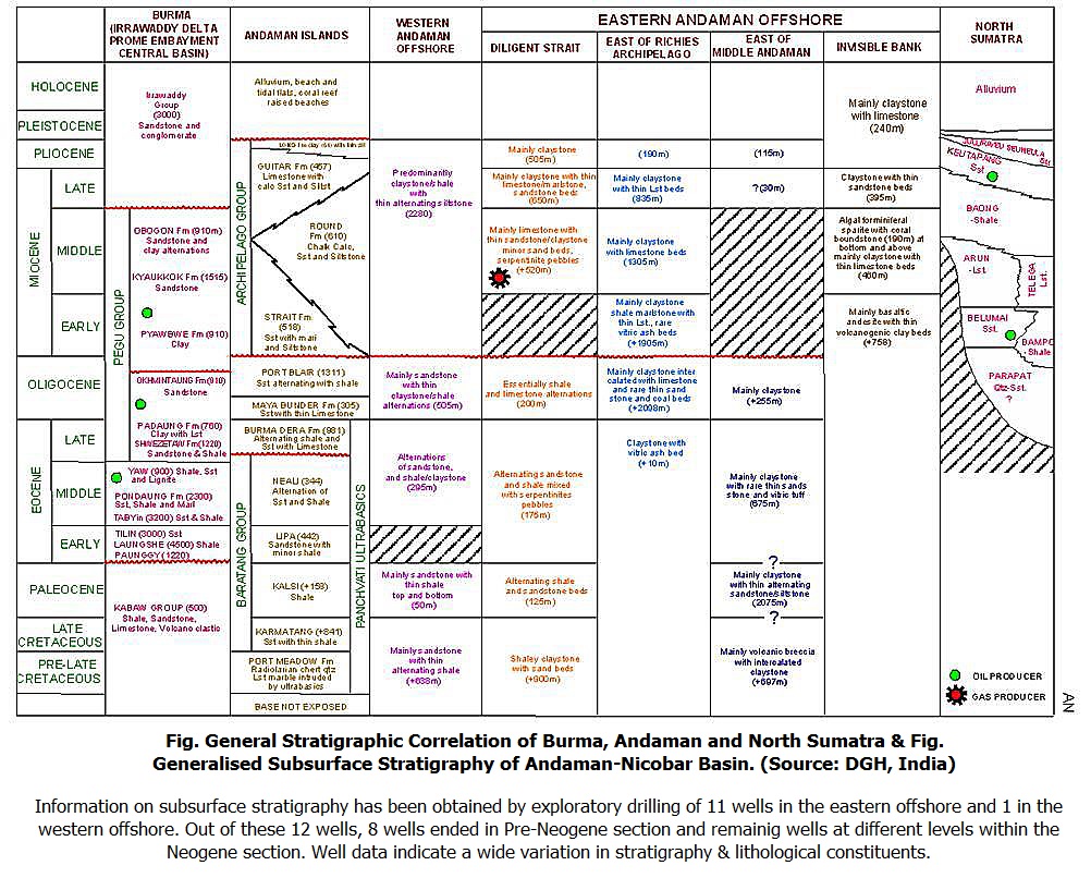
[Figure 3: Generalized Subsurface Stratigraphy of Andaman-Nicobar Basin (from dghindia.gov.in)]
Relationships and Distribution
Lower contact
Conformable lower boundary with the Strait Fm.
Upper contact
Hiatus: At Meetha Nala section, where the Inglis Formation is overlain by Long Fm, the contact is marked by a hiatus (Pandey and Dave, 1998).
Regional extent
Other outcrops of Inglis Formation are reported by Srinivasan and Azmi (1976b) at John Lawrence Island and at Lacam Point, Meetha Nala, Kalapathar and West Coast sections in Havelock Island. At East Coast Cliff sections in Havelock Island.
[Figure 4: General Stratigraphic Correlation of Burma, Andaman and North Sumatra (from dghindia.gov.in)]
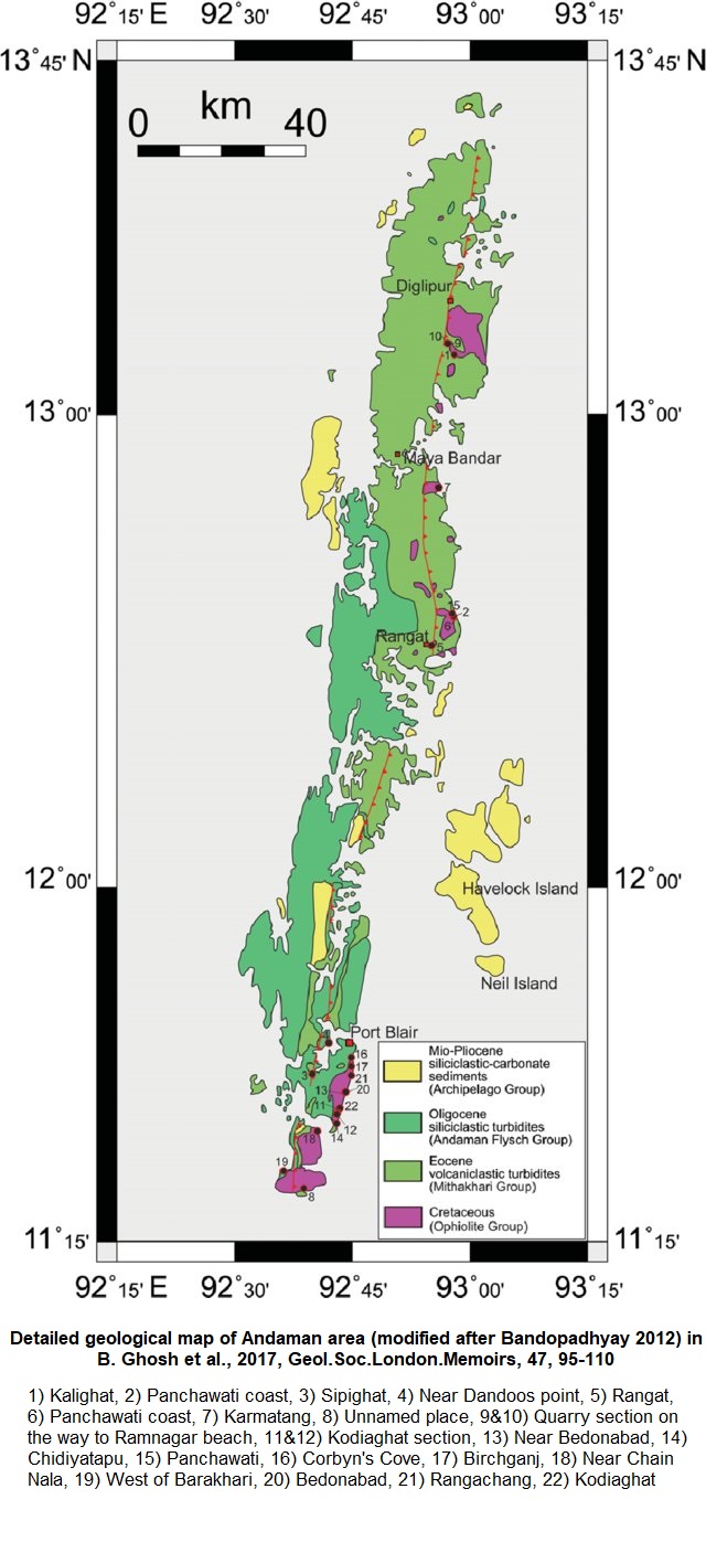
[Figure 5: Detailed geological map of Andaman area (modified after Bandopadhyay 2012) showing locations mentioned in numbers in B. Ghosh et al., 2017, Geo.Soc.London.Memoirs, 47, 95-110)]
GeoJSON
Fossils
Srinivasan and Azmi (1976b) recorded foraminifera of Globigerinatella insueta Zone to Globoratalia peripheroronda Zone for this formation. The Orbulina datum lies within Inglis Formation in the type section.
Age
Depositional setting
Lower bathyal to upper abyssal
Additional Information
